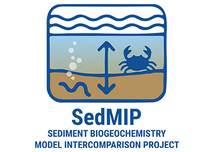
Ocean Carbon & Biogeochemistry
Studying marine ecosystems and biogeochemical cycles in the face of environmental change
  • Home
  • About OCB
    • About Us
    • Scientific Breadth
      • Biological Pump
      • Changing Marine Ecosystems
      • Changing Ocean Chemistry
      • Estuarine and Coastal Carbon Fluxes
      • Ocean Carbon Uptake and Storage
      • Ocean Observatories
    • Code of Conduct
    • Get Involved
    • Project Office
    • Scientific Steering Committee
    • OCB committees
      • Ocean Time-series
      • US Biogeochemical-Argo
      • Ocean-Atmosphere Interaction
  • Activities
    • Summer Workshop
    • OCB Webinars
    • Guidelines for OCB Workshops & Activities
    • Topical Workshops
      • CMIP6 Models Workshop
      • Coastal BGS Obs with Fisheries
      • C-saw extreme events workshop
      • Expansion of BGC-Argo and Profiling Floats
      • Fish, fisheries and carbon
      • Future BioGeoSCAPES program
      • GO-BCG Scoping Workshop
      • Lateral Carbon Flux in Tidal Wetlands
      • Leaky Deltas Workshop – Spring 2025
      • Marine CDR Workshop
      • Ocean Nucleic Acids ‘Omics
      • Pathways Connecting Climate Changes to the Deep Ocean
    • Small Group Activities
      • Aquatic Continuum OCB-NACP Focus Group
      • Arctic-COLORS Data Synthesis
      • BECS Benthic Ecosystem and Carbon Synthesis WG
      • Carbon Isotopes in the Ocean Workshop
      • CMIP6 WG
      • Filling the gaps air–sea carbon fluxes WG
      • Fish Carbon WG
      • Meta-eukomics WG
      • mCDR
      • Metaproteomic Intercomparison
      • Mixotrophs & Mixotrophy WG
      • N-Fixation WG
      • Ocean Carbonate System Intercomparison Forum
      • Ocean Carbon Uptake WG
      • OOI BGC sensor WG
      • Operational Phytoplankton Observations WG
      • Phytoplankton Taxonomy WG
    • Other Workshops
    • Science Planning
      • Coastal CARbon Synthesis (CCARS)
      • North Atlantic-Arctic
    • Ocean Acidification PI Meetings
    • Training Activities
      • PACE Hackweek 2025
      • PACE Hackweek 2024
      • PACE Training Activity 2022
  • Science Support
    • Data management and archival
    • Early Career
    • Funding Sources
    • Jobs & Postdocs
    • Meeting List
    • OCB Topical Websites
      • Ocean Fertilization
      • Trace gases
      • US IIOE-2
    • Outreach & Education
    • Promoting your science
    • Student Opportunities
    • OCB Activity Proposal Solicitations
      • Guidelines for OCB Workshops & Activities
    • Travel Support
  • Publications
    • OCB Workshop Reports
    • Science Planning and Policy
    • Newsletter Archive
  • Science Highlights
  • News

Archive for Early Career

Leaky Deltas workshop summary

Posted by mmaheigan 
· Thursday, April 10th, 2025 

The Leaky Deltas OCB workshop was held 17-20 March 2025 at Louisiana State University, in Baton Rouge, USA, which is situated within the Mississippi River delta. We brought together 57 members of the research community who study river deltas in the context of the global carbon cycle. The goal of the workshop was to create a community consensus on the state of delta carbon cycle science, identify critical knowledge gaps, and brainstorm opportunities and priorities for future research efforts. Participants ranged in career stage from graduate student to senior scientist, and from disciplines ranging from biogeochemistry to geomorphology, river scientists to oceanographers; and scientists using a variety of methodological approaches.

The workshop included five oral sessions, four breakout sessions, numerous opportunities for discussion over meals and coffee breaks, a trip to the LSU Center for River Studies, and a workshop dinner. The breakout sessions were formatted to encourage discussion among interdisciplinary groups of scientists at different career stages. During breakout session 1, participants were randomly assigned to groups that spanned career stages and expertise. This session was aimed at identifying grand challenges in delta carbon cycle science. Breakout session 2 had a disciplinary focus, where we broke out into groups of biogeochemistry, geomorphology, modeling, and ecosystems. Breakout session 3 was broken out into groups based on physical domains of the delta: river, wetlands, subaqueous delta, shelf, and continental slope. A highlight of day three was a field trip to the LSU Center for River Studies, where workshop participants were guided on a tour of the historical changes of the Mississippi River Delta, as well as the large-scale physical model of the delta. On the fourth and final day of the workshop, we had short break-out sessions and reconvened as a whole to synthesize ideas and circle back to the workshop objectives.

In summary, the workshop resulted in a consensus on the key knowledge gaps and research grand challenges, which included constraining the composition of organic matter, the timescales of geomorphic processes, biogeochemical reaction rates, impacts of human perturbations and extreme events, and challenges in monitoring deltaic processes. Workshop participants now have the task of writing a position paper that summarizes these grand research challenges, identifies the data needed to address these challenges, and recommends a framework and directions for future research. One outcome of the workshop included the structure and organization for this paper. The early career workshop participants will also lead an early-career-led perspective paper that discusses ideas for integrating new technologies and methodologies to address these grand challenges and identifies future challenges for the delta science community.

Learn more about this workshop

PACE Hackweek

Posted by mmaheigan 
· Friday, February 28th, 2025 

The NASA Plankton, Aerosol, Cloud, ocean Ecosystem (PACE) Project and Ocean Carbon & Biogeochemistry (OCB) Program are hosting a second PACE Data Hackweek. This is a one-week social coding event that will include a combination of lectures, tutorials, and project work (data processing and analysis) that will kick-start research using the Earth science data streams generated by the OCI, SPEXone, and HARP2 instruments on board the observatory. Other projects that combine PACE data with other satellite data, such as from EarthCARE, TROPOMI, or SWOT are also encouraged. Participants will gain behind-the-scenes access to all aspects of PACE.

  • Data and compute resources will be provided on an AWS cloud platform, and tutorials will be conducted in Python. Participants must have some experience (i.e. able to work independently) with Python in order to benefit from this Hackweek. *We will also consider applicants who are proficient in a different programming language who are transitioning to Python.*
  • We anticipate accepting ~40 participants (from student to professional career stages).
  • All lectures and tutorials will be recorded and made available on the course web page.

3-7 August 2025
University of Maryland Baltimore County (UMBC)

Learn more and apply by March 24

PACE introduction course – free in english and in spanish

Posted by mmaheigan 
· Tuesday, August 27th, 2024 

Introduction to Plankton, Aerosol, Cloud, Ocean Ecosystem (PACE) Hyperspectral Observations for Water Quality Monitoring

This online, introductory course will be cost-free and have three, 1.5-hour parts:

Part 1: Introduction to the PACE Mission for Water Quality Monitoring (September 25th)

Part 2: Overview, Access, and Analysis of PACE Ocean Color Data Products (October 2nd)

Part 3: Access and Visualization of PACE-OCI Data using Python/Jupyter Notebook Software (October 9th)

Registration is now open – course will be offered in English AND Spanish!

For more information and to register visit:

  • ENGLISH: https://appliedsciences.nasa.gov/get-involved/training/english/arset-introduction-plankton-aerosol-cloud-ocean-ecosystem-pace
  • SPANISH: https://appliedsciences.nasa.gov/get-involved/training/english/arset-introduccion-los-datos-hiperespectrales-de-la-mision-plankton

NASA’s ARSET program offers free, online training on using Earth Observations for decision making that are open to the public. Courses are designed for a broad audience, ranging from introductory to advanced. For more on ARSET and to see their wealth of upcoming and previous trainings, please visit their website.

OCB Supports Early Career Participants in Cornell Satellite Remote Sensing Training Program

Posted by mmaheigan 
· Thursday, July 25th, 2024 

OCB Supports Early Career Participants in Cornell Satellite Remote Sensing Training Program 2024

María del Alma Concepción Rodríguez
Alba Guzman-Morales
Alba Guzman-Morales
Kiwanuka Moses
Kiwanuka Moses
Michelle Wagner
Michelle Wagner

Michelle Wagner is in her first year of master’s study at the City College of New York. Her research interest is in monitoring the responses of coastal systems to natural and anthropogenic stressors. After graduating from the City College of New York, Michelle joined the Tzortziou Bio-optics lab at CCNY. Her work utilized HPLC and microscopic analysis as well remote sensing data to characterize seasonal shifts in phytoplankton community composition in the Long Island Sound estuary and increasing intensity in red tide events and other HABS.

I am very happy to have been a part of the Cornell 2024 Satellite Remote Sensing Training Program this summer. As someone who is new to the world of satellite data processing, I could not have asked for a better introduction. Dr. Monger’s strong expertise as well as his guidance and encouragement gave me the confidence to tackle hard problems. The course not only introduced me to Python programming but also provided a range of tools for handling satellite data. It significantly broadened my perspective and deepened my understanding of satellite remote sensing. I really enjoyed this course and would recommend it to anyone pursuing satellite remote sensing and ocean color analysis. I would like to say thank you to Dr. Bruce Monger and OCB for this amazing experience!


Alba Guzmán Morales was born in Arecibo, Puerto Rico. She received her B.S. in Biology and M.S. in Biological Oceanography from the University of Puerto Rico Mayagüez Campus in 2019 and 2024, respectively. Her research focused on using satellite imagery to study water clarity trends in Puerto Rico to evaluate management efforts in a watershed. As a NOAA Cooperative Science Center in Atmospheric Sciences and Meteorology Fellow, she evaluated the applicability of a NOAA Kd490 product by comparing it with in situ Kd490. She has also been involved in Unmanned Aerial Vehicle research to measure salinity.

Cornell's Satellite Remote Sensing course was what I expected and more. While I had previous experience processing satellite data the course provided me with tools I hadn’t yet had the opportunity to use in my work. It was amazing to process and visualize L1 to L2 ocean color, SST, wind, and altimetry data. I am deeply thankful to the great instructors Dr. Bruce Monger and Jillian Steinmetz, to the colleagues I met during the course as well as OCB for supporting this opportunity. Let the research continue!


Kiwanuka Moses: I’m a second-year Earth Systems Science PhD Student working under Dr. Sridhar Maruthi Balaji Bhaskar at Florida International University. My research uses remote sensing and machine learning to estimate water quality parameters for inland lakes (Okeechobee and Victoria). The goal is to develop monitoring algorithms based on Landsat 8 OLI and Sentinel 2 MSI images. These models will be correlated with results from NASA SeaDAS software.

The Cornell Satellite Remote Sensing course was a great experience. I learned multiple ways of downloading datasets, cleaning them, and channeling them to a particular study area. I also learned how to use Python command lines for image processing using NASA SeaDAS and better understood the different components of oceanography (Physical and biological) as a field. There was a great improvement in my programming skills. I enjoyed every moment with Dr. Bruce Monger and Ms. Jillian Elaine, the TA. Their patience regarding the questions directed at them was exceptional. I recommend this course to anyone interested in remote sensing and ocean color. Special thanks to Ocean Carbon and Biogeochemistry (OCB) for the sponsorship and for making this a reality for me.


María del Alma Concepción Rodríguez's journey into water resources began during her undergraduate studies at the Polytechnic University of Puerto Rico. Earning a Bachelor of Science in Chemical Engineering and a master’s in environmental management, she immersed herself in internships and projects related to the water industry. These experiences profoundly impacted her, highlighting water's vital role as the driving force of nature and the center of life.

As she advanced to her PhD in Civil Engineering, now going into her third year, María del Alma’s passion for water conservation grew stronger. She became particularly concerned about the potential contamination from regulated wastewater disposals in the waters surrounding the Caribbean Island of Puerto Rico. This concern sparked a compelling desire to delve deeper into understanding their impacts. Her doctoral research is a testament to this dedication. It focuses on how effluent discharges affect oceanic waters and aims to develop a comprehensive evaluation methodology. María del Alma leverages innovative GIS techniques to identify contamination hotspots through spatial data analysis. Her goal is to create geospatial models that visualize current and future scenarios, providing a clearer picture of the potential impacts on our waters.

Through her work, María del Alma strives to protect and conserve our natural environment, recognizing that safeguarding water resources is not just important but essential.

Imagine learning about the intricacies of satellite remote sensing while collaborating with peers, all within the vibrant academic atmosphere of Cornell University—that was my experience in a nutshell. The 2024 Cornell Satellite Remote Sensing Summer Course was an enriching experience that deepened my technical knowledge and connected me with a network of passionate individuals in the remote sensing community. The course’s rigorous curriculum laid a strong foundation for my understanding of the field and opened my eyes to the vast remote sensing applications. We delved into the core principles of remote sensing, how the satellite data is collected, and the processing of such data using coding. Dr. Bruce Monger was an excellent instructor who guided us throughout the course while getting a better understanding of each of our investigations. Teaching assistant Jillian Steinmetz was knowledgeable and always willing to assist us. The course featured lectures and hands-on workshops where you were given exercises to work on the computer using Python and SeaDAS to understand the processing of satellite imagery. One of the most exciting moments of the course was the hands-on experience with satellite data—using advanced software to process and analyze the data and turn the raw information into meaningful insights for my PhD research. Participating in the 2024 Cornell Satellite Remote Sensing Training Program was a transformative experience that broadened my horizons and passion for using innovative technology in real-world water applications.

PACE HACKWEEK – apply by March 17

Posted by mmaheigan 
· Sunday, March 10th, 2024 

Learn more and apply

OCB2024 Plenary Sessions Announced

Posted by hbenway 
· Friday, February 9th, 2024 

OCB2024: June 10-13, 2024 (Woods Hole, MA)

Registration will open in early April

  • Submarine groundwater discharge (Chairs: Shaily Rahman, Kanchan Maiti, Yige Zhang)
  • Coupled biogeochemical cycles - interconnected controls on ocean fertility (Chairs: Victoria Steck, P. Dreux Chappell, Zachary Erickson, Jessica Luo, Kristen Krumhardt, Randie Bundy)
  • Air-sea interactions (Chairs: Rachel Stanley, David “Roo” Nicholson, Tim DeVries)
  • Marine viruses (Chairs: Jessica Labonté, Sheri Floge, Jeff Bowman)
  • Fast processes in the surface ocean - the power of geostationary satellites (Chairs: Joe Salisbury, Blake Schaeffer, Maria Tzortziou, Antonio Mannino, Melissa Meléndez, Susanne Craig)

Early career support for Ocean Optics XXIV

Posted by mmaheigan 
· Thursday, March 29th, 2018 

OCB is providing early career support for the Ocean Optics XXIV Conference,  October 7-12, 2018 in Dubrovnik, Croatia.
Are you an early career scientist looking for a perfect place to present your latest discoveries (and you need some travel support to do so)? Look no more – Ocean Optics XXIV conference registration is open, and OCB is offering travel support to members of their community to participate. See registration page for details.


OCB supports early career participation in 3rd International Ocean Colour Science Meeting

Posted by mmaheigan 
· Tuesday, June 6th, 2017 

OCB-sponsored participants of 3rd International Ocean Color Meeting in May 2017.

Christiana Ade is a first-year PhD student at North Carolina State University in the Marine, Earth and Atmospheric Sciences Department. She researches wetlands and coastal environments using satellite remote sensing and field measurements. Her research includes water quality mapping, establishing new environmental indicators, and determining satellite resolution requirements for adequately monitoring wetlands.

“As a master’s student, I focused on wetland vegetation, but for my PhD I am shifting toward water quality monitoring. The 2017 IOCS meeting occurred at a critical time in my career as I begin this research transition. IOCS allowed me to meet several prominent researchers and advanced students that I foresee myself collaborating with in the future, thus furthering my long-term objective of becoming a researcher in a national lab or university professor. I presented a poster at IOCS on some preliminary research and received extremely useful feedback, which I am already implementing. Although the conference was great for networking, it was most beneficial for expanding my understanding of current limitations and future opportunities in remote sensing of water. In particular, the breakout sessions provided me with several insights on hot-button topics and gave me confidence that the ocean color community will aid researchers invested in coastal applications to determine what sensor resolutions are needed to monitor these environments. Meetings like this ensure that the necessary technology gets built and launched. I would like to thank all the organizers, speakers, and the OCB for their positive impact on my research career.”


Henry Houskeeper is a third year Ocean Sciences PhD student working with Raphael Kudela at the University of California, Santa Cruz. Henry investigates the optical properties of dinoflagellate red tides. His broader interests include remote sensing of the coastal ocean, coastal upwelling ecosystem dynamics, and phytoplankton ecology. 

“Attending the IOCS meeting was an excellent opportunity for me to receive thoughtful feedback on my research. IOCS connected me with helpful members of the ocean color community and exposed me to a diverse assemblage of ocean color research projects. The support from OCB made this valuable experience possible for me.”

Suhey Ortiz Rosa is a PhD student conducting research with Dr. Roy Armstrong in Bio-Optical Oceanography at the Department of Marine Sciences at the University of Puerto Rico- Mayagüez (UPRM). In 2005, she completed a B.S. in Coastal Marine Biology at the University of Puerto Rico- Humacao, and in 2010, a MS in Chemical Oceanography at UPRM. Suhey’s work focuses on the biogeochemistry of coastal waters and coral reefs, validating algorithms from satellite imagery of complex optical waters, remote sensing, and GIS. Previously, she worked on CDOM characterization with PARAFAC, mapping marine species distribution with the GAP-Analysis Project of Puerto Rico and later with watershed analysis of sedimentation processes on coral reefs.

“The International Ocean Color Science Meeting was a unique experience. Networking with the international community to address common issues on satellite imagery analysis benefits my research tremendously. I am now able to communicate with leading experts that work with the latest processes, allowing me to conduct more accurate and efficient research. The workshop on Copernicus Data was also very helpful, providing hands-on personalized experience. The cultural diversity and different research projects presented made this conference an advantage for me as an early career ocean color researcher. The information I obtained expands my options for new opportunities and ideas in research. It is fundamental for young scientists to remain up to date with the innovations in their current research topic. Thanks to the OCB program for making this experience possible!”


Sara Rivero-Calle is a postdoctoral researcher at the Levine Lab in the University of Southern California interested in projects that involve large datasets, combining remote sensing and in situ data to answer large-scale ecological questions. She first learned about satellite remote sensing during her MS program at the University of Puerto Rico working on mesophotic reef sponge ecology using Autonomous Underwater Vehicles. She earned a PhD from Johns Hopkins University, where she used the Continuous Plankton Recorder survey to study long-term changes in North Atlantic phytoplankton communities. Currently, Sara is conducting postdoctoral research on fine-scale variability and patchiness, combining remote sensing, float, and HPLC data with numerical models.

“Attending IOCS was a fantastic experience. I was invited to give a talk on the global distribution of Trichodesmium for the special session on Trichodesmium. This was a great opportunity, not only for the exposure, but also because I am now collaborating with the organizers on writing a white paper with recommendations for remote sensing of Trichodesmium from space. This is perfect timing, given the new sensors with higher spatial and spectral resolution currently being developed and forthcoming satellite missions. I also noticed a clear interest in the remote sensing community to work closely with modelers and I think I can help bridge the two communities. I will be collaborating with another working group focused on carbon cycling. One of the things I liked most was the IOCS meeting structure—splitting us up into working groups, identifying current challenges and brainstorming together on how to deal with them and move forward. This meeting is not focused on presenting work but on setting new goals and working towards them. I also liked that the IOCS meeting facilitates direct communication with program managers and representatives from all space agencies and how the agencies came to the meeting to hear what the scientific community needs to advance satellite remote sensing. In summary, the IOCS meeting is the perfect venue for international scientific networking and I am so grateful to OCB for supporting us at an early stage of our career, thanks for believing in us!”


Sarah Schlunegger is a PhD Student in the Program of Atmospheric and Oceanic Sciences, advised by Prof. Jorge Sarmiento. Sarah uses Earth System Models to predict the timing, sequence and inter-dependence of emerging anthropogenic signals in the ocean, with a focus on the ocean’s acquisition of anthropogenic carbon and heat. The ocean provides a climate service by absorbing the atmosphere’s excess carbon and heat but at a cost, namely acidification and warming, which deteriorate marine habitats. Sarah’s primary research goal is to identify when and where changes in these heat/carbon sinks and their resulting impacts will be detectable in the ocean.

“As a climate modeler, I have limited daily interactions with observationalists, despite my using satellite observations as a component of my own research. The 2017 International Ocean Colour Science Meeting was the perfect platform to cure this condition! Hearing talks and discussion from the lead scientist and engineers who have spent decades developing and perfecting satellite observation platforms has expanded my understanding and appreciation for the work behind the end-product. I enjoyed listening to the expert panels parse through upcoming innovations to address atmospheric correction, a major challenge faced by the community. The fellow conference attendees were friendly and encouraging, and of course, Lisbon is a magical city!”


A Training Course on Marine Radioactivity August 13, 2017

Posted by mmaheigan 
· Monday, May 15th, 2017 

A Training Course on Marine Radioactivity in association with Goldschmidt, August 13, 2017. The event, organized by SCOR 146 WG, will include: An introduction to Radionuclides, Natural, Anthropogenic, and Cosmogenic Radioisotopes and their General Applications in the Marine environment, and Radioecology. Specific lectures will delve more deeply into specific applications and include topics such as applications of radionuclides to sediment age dating, submarine groundwater discharge, and biological mediated carbon export.

Lecturers:

  • Dr. Ken Buesseler, Center for Marine and Environmental Radioactivity, Woods Hole Oceanographic Institution, USA
  • Dr. Minhan Dai, State Key Laboratory of Marine Environmental Science, Xiamen University, China
  • Dr. Claudia Benitez‐Nelson, University of South Carolina, USA
  • Dr. Sabine Charmasson, ISRN, Laboratory for Research on Transfers in the Environment, France
  • Dr. Pere Masque, Edith Cowan University (Australia) and Universitat Autònoma de Barcelona (Catalonia, Spain)
  • Dr. Willard S. Moore, University of South Carolina, USA
  • Dr. John Smith, Bedford Institute of Oceanography, Dartmouth, NS, Canada

Detailed agenda and more information

The course is open to 25 students and early career scientists interested in radiochemisty‐related fields.

Please use the Goldschmidt registration form to register for this workshop and for the Goldschmidt meeting. The workshop registration fee (40 Euros) will be supported in large part by the Center for Marine and Environmental Radioactivity at WHOI.

Cornell Satellite Remote Sensing Training Course June 3 – 17, 2016 (Ithaca, NY)

Posted by mmaheigan 
· Friday, November 18th, 2016 

OCB-sponsored participants of the Cornell Satellite Remote Sensing Course held in June 2016 in Ithaca, NY.

Emily Bockmon studies carbonate chemistry in the ocean, focusing on best practices for measurement and calibration of instrumentation. In 2014, she completed her PhD at Scripps Institution of Oceanography where she is currently she is working as a researcher. Next year, Emily will begin as an Assistant Professor of Chemical Oceanography at California Polytechnic State University, San Luis Obispo. She is excited to focus on the Central Californian coastal upwelling environment and the local biogeochemistry and ocean acidification.

“For me, this class really was a crash course introducing me to the world of satellite measurements and data. I am very grateful to Bruce and the TAs for their patience and facilitation of the course, as well as my amazing peers who were willing to offer trouble-shooting help and great conversation. I appreciated how much hands-on work we did, diving into various datasets and possibilities for processing them. I walked away with practical knowledge and practice in collecting and using satellite data, which is exactly what I was hoping for. I feel as though I have been exposed to a new world of data, beyond the bench chemistry I am familiar with, and I am looking forward to pairing these measurements in the future.”


Phil Bresnahan received his PhD from Scripps Institution of Oceanography in 2015. Working in Professor Todd Martz’s lab, he developed in situ sensors to study the marine inorganic carbon system. His two main efforts involved designing a microfluidic total dissolved inorganic carbon analyzer for Argo floats and applying SeaFET/SeapHOx sensor technology in coastal ecosystems. Bresnahan is now an Environmental Scientist at the San Francisco Estuary Institute, a non-profit research organization focused on issues of mutual scientific and management-related importance in San Francisco Bay. At SFEI, he leads the efforts to characterize SF Bay’s biogeochemical variability utilizing moored sensors.

“I couldn’t speak more highly of the Cornell Satellite Remote Sensing Course. Every aspect (well, except for the cold showers—hopefully Cornell has fixed that by now!) exceeded my expectations. Bruce Monger’s teaching style was thoughtful and effective and he was a great organizer; his passion for education and remote sensing reflectance was inspiring. While my core expertise is in situ sensor development and application, I fully realize the necessity of combining multiple tools and analytical approaches. I’m excited to see what doors the course opens for me! PS: I’m processing Landsat8/OLI data using my newly acquired skills as I write this. Thanks, OCB and Bruce, for a great opportunity!”


Dylan Catlett is a 2nd year PhD student in marine science at the University of California, Santa Barbara, and is advised primarily by Dave Siegel. Currently, his research interests lie in linking optical, chemotaxonomic, and molecular indices of phytoplankton community structure and diversity. Prior to beginning his graduate degree, he studied biology and chemistry at the University of North Carolina, Chapel Hill, where he also conducted research on the molecular responses of diatoms to iron and light limitation.

“The Satellite Remote Sensing course at Cornell was phenomenal. The course was extremely hands-on and application-oriented, making it an excellent and practical introduction to ocean color remote sensing and programming with Python. By the end of the course, I was able to comfortably obtain, process, and analyze satellite ocean color data. I returned to work after the course with much improved programming skills, which has already benefited my research immensely. The class was one of the most well organized I have ever experienced, and the instructor did a wonderful job creating a productive and fun learning environment. My fellow students led to interesting discussions, both in and outside of class, and further contributed to the educational experience. Finally, Ithaca was a joy to explore on days off. I would highly recommend this course to anyone with an interest in using ocean color remote sensing products in their research.”


Jack Pan is a third-year PhD student working with Dr. Maria Vernet and Dr. Greg Mitchell at the Scripps Institution of Oceanography (SIO). He obtained his BS in Earth & Environmental Sciences at the University of California, Irvine, and MS in Marine Biology at SIO. Prior to enrolling at SIO, Jack worked on numerous projects at the Jet Propulsion Laboratory focusing on integrating oceanographic studies with applied sciences. In order to achieve a better understanding of the rapidly changing polar ecology and biogeochemistry, he is interested in utilizing optics-focused techniques to assimilate field measurements, remote sensing, and numerical models.

“I have gained a tremendous amount of knowledge during the Cornell Satellite Remote Sensing course in summer 2016. During this class, I learned to process and effectively utilize satellite data for my research; materials from every lecture and lab session were almost instantly helpful to my work. The course instructor, Dr. Bruce Monger, is a very kind and patient individual. He explained the material very clearly and made sure every student was doing well; and moreover, he fostered a very friendly learning environment for students to fully engage in the material and help each other to excel. Personally, I am still in contact with many of my classmates, and even formed academic collaborations with some of them. This is one of the best classes that I have ever taken, and I would highly recommend it to anyone; but more importantly, I would like to sincerely thank OCB for giving me the opportunity to attend this class.”


Melishia Santiago is a third year PhD student in the Graduate School of Geography at Clark University. Her work focuses on the study of Arctic marine environments and the combination of in situ measurements and satellite remote sensing. She investigates chromophoric dissolved organic matter (CDOM) distribution and sea ice extent in the Bering, Chukchi, and western Beaufort seas. More generally, Melishia is interested in the biogeochemical impacts in the water column as sea ice declines in the western Arctic Ocean.

“All the skills and knowledge that I learned in the Cornell Satellite Remote Sensing course were really invaluable. The instructor and TAs were passionate about the subject. Thus, I was able to understand ocean color remote sensing concepts and apply them to my own research. It was truly a life changing experience!”


Priya Sharma is currently a doctoral candidate at University of Pennsylvania studying “Spatiotemporal dynamics of phytoplankton biomass from ocean color remote sensing and ensemble climate model simulations.” Her research interests include assessing the evolution of phytoplankton group sizes and their functional types, ocean biological pump and response of ocean biology to various ENSO states. She completed her Master’s degree at the University of South Pacific and also worked for the Pacific Center of Environment and Sustainable Development doing oceanographic research on tropical cyclones and exploring links between climate change and social science (e.g., traditional knowledge).

“Having the amazing opportunity to attend the 2016 Cornell Satellite Remote Sensing Course has deepened my knowledge of remote sensing and optical properties. The most exciting experience for me was the processing of various levels of geophysical satellite products to obtain spatial information. This course struck an equitable balance of theoretical and hands-on practical lessons. Importantly, the data analysis tools and techniques that were taught were well aligned with my PhD thesis objectives, including empirical orthogonal function (EOF) analysis. I was also form collaborations with other participants of the course. Bruce is a very affable and approachable person, which made my experience during the Cornell course a very gratifying one.”


Inia M. Soto Ramos is currently a CONCORDE (Consortium in Coastal River-Dominated Ecosystems) postdoctoral researcher in the Division of Marine Science, University of Southern Mississippi at Stennis Space Center. She earned her BS in biology and education at the University of Puerto Rico, Mayaguez. She completed her MS and PhD degrees in biological oceanography at the University of South Florida. Her research interests include ocean color satellite remote sensing of coastal ecosystems, with emphasis on phytoplankton blooms and coastal ecosystems. Her current research is focused on coupling ocean color satellite imagery and high-resolution circulation models to understand the three-dimensionality of the Mississippi River Plume and the bio-optical surface response.

“The Cornell Satellite Remote Sensing Course was an outstanding experience! Dr. Bruce Monger is an exceptional professor and the course was applicable to any level of experience. Dr. Monger went the extra mile to make sure that everyone could adjust the learning experience to their own research. In my case, I have been working with satellite imagery for a few years; however I was not up to date on the technology and found myself with outdated skills. This course helped me get back on track and update my knowledge, especially my programming skills. Now, I feel much more confident with my skills and have since set up my personal computer system to integrate everything I learned during the course. I have been using the Python codes we learned during the class to process NASA’s satellite imagery for two harmful algal bloom manuscripts (in progress) and for several other projects within my group. I have no words to truly express my gratitude to Dr. Monger, the enthusiastic and motivated TAs, Cornell University, and OCB for making this opportunity a reality for me and the other 8 talented early career scientists!”


After pursuing a BSc in Earth System Sciences at McGill University and a MSc in Earth and Ocean Sciences at the University of Victoria, Jan-Erik Tesdal began working toward a PhD in Earth and Environment Sciences at Columbia University. His broad undergraduate training emphasized a holistic view of the Earth System. Continuing in this spirit, his MSc research project focused on one of the iconic examples of how the biosphere can interact with the climate system: the CLAW hypothesis. For his PhD work, Jan-Erik narrowed his focus slightly to biological oceanography. He is especially intrigued by the interaction of the marine ecosystems with the physical environment. His current research centers on assessing the impact of melting Arctic Sea ice and freshwater flux on phytoplankton productivity and carbon export in the North Atlantic.

“The Cornell Satellite Remote Sensing course was a great experience for me. Learning the material and working through problem sets in a group setting was fun and exciting. The instructor and his TAs were very amiable and helpful, and the method-oriented teaching was ideal to help me learn the skills necessary for working with satellite data. It was especially useful to learn about the processing of satellite imagery through the conjunction of Python programming and SeaDAS. In addition to the great deal that I learned, I am very grateful for the opportunity afforded by this course to build new relationships from around the world. I can’t imagine how my current research would suffer had I not taken this course.”

Next Page »

Filter by Keyword

abundance acidification additionality advection africa air-sea air-sea interactions algae alkalinity allometry ammonium AMO AMOC anoxic Antarctic Antarctica anthro impacts anthropogenic carbon anthropogenic impacts appendicularia aquaculture aquatic continuum aragonite saturation arctic Argo argon arsenic artificial seawater Atlantic atmospheric CO2 atmospheric nitrogen deposition authigenic carbonates autonomous platforms bacteria bathypelagic BATS BCG Argo benthic bgc argo bio-go-ship bio-optical bioavailability biogeochemical cycles biogeochemical models biogeochemistry Biological Essential Ocean Variables biological pump biophysics bloom blue carbon bottom water boundary layer buffer capacity C14 CaCO3 calcification calcite carbon carbon-climate feedback carbon-sulfur coupling carbonate carbonate system carbon budget carbon cycle carbon dioxide carbon export carbon fluxes carbon sequestration carbon storage Caribbean CCA CCS changing marine chemistry changing marine ecosystems changing marine environments changing ocean chemistry chemical oceanographic data chemical speciation chemoautotroph chesapeake bay chl a chlorophyll circulation CO2 coastal and estuarine coastal darkening coastal ocean cobalt Coccolithophores commercial community composition competition conservation cooling effect copepod copepods coral reefs CTD currents cyclone daily cycles data data access data assimilation database data management data product Data standards DCM dead zone decadal trends decomposers decomposition deep convection deep ocean deep sea coral denitrification deoxygenation depth diatoms DIC diel migration diffusion dimethylsulfide dinoflagellate dinoflagellates discrete measurements distribution DOC DOM domoic acid DOP dust DVM ecology economics ecosystem management ecosystems eddy Education EEZ Ekman transport emissions ENSO enzyme equatorial current equatorial regions ESM estuarine and coastal carbon fluxes estuary euphotic zone eutrophication evolution export export fluxes export production extreme events faecal pellets fecal pellets filter feeders filtration rates fire fish Fish carbon fisheries fishing floats fluid dynamics fluorescence food webs forage fish forams freshening freshwater frontal zone functional role future oceans gelatinous zooplankton geochemistry geoengineering geologic time GEOTRACES glaciers gliders global carbon budget global ocean global warming go-ship grazing greenhouse gas greenhouse gases Greenland ground truthing groundwater Gulf of Maine Gulf of Mexico Gulf Stream gyre harmful algal bloom high latitude human food human impact human well-being hurricane hydrogen hydrothermal hypoxia ice age ice cores ice cover industrial onset inland waters in situ inverse circulation ions iron iron fertilization iron limitation isotopes jellies katabatic winds kelvin waves krill kuroshio lab vs field land-ocean continuum larvaceans lateral transport LGM lidar ligands light light attenuation lipids low nutrient machine learning mangroves marine carbon cycle marine heatwave marine particles marine snowfall marshes mCDR mechanisms Mediterranean meltwater mesopelagic mesoscale mesoscale processes metagenome metals methane methods microbes microlayer microorganisms microplankton microscale microzooplankton midwater mitigation mixed layer mixed layers mixing mixotrophs mixotrophy model modeling model validation mode water molecular diffusion MPT MRV multi-decade n2o NAAMES NCP nearshore net community production net primary productivity new ocean state new technology Niskin bottle nitrate nitrogen nitrogen cycle nitrogen fixation nitrous oxide north atlantic north pacific North Sea nuclear war nutricline nutrient budget nutrient cycles nutrient cycling nutrient limitation nutrients OA observations ocean-atmosphere ocean acidification ocean acidification data ocean alkalinity enhancement ocean carbon storage and uptake ocean carbon uptake and storage ocean color ocean modeling ocean observatories ocean warming ODZ oligotrophic omics OMZ open ocean optics organic particles oscillation outwelling overturning circulation oxygen pacific paleoceanography PAR parameter optimization parasite particle flux particles partnerships pCO2 PDO peat pelagic PETM pH phenology phosphate phosphorus photosynthesis physical processes physiology phytoplankton PIC piezophilic piezotolerant plankton POC polar polar regions policy pollutants precipitation predation predator-prey prediction pressure primary productivity Prochlorococcus productivity prokaryotes proteins pteropods pycnocline radioisotopes remineralization remote sensing repeat hydrography residence time resource management respiration resuspension rivers rocky shore Rossby waves Ross Sea ROV salinity salt marsh satellite scale seafloor seagrass sea ice sea level rise seasonal seasonality seasonal patterns seasonal trends sea spray seawater collection seaweed secchi sediments sensors sequestration shelf ocean shelf system shells ship-based observations shorelines siderophore silica silicate silicon cycle sinking sinking particles size SOCCOM soil carbon southern ocean south pacific spatial covariations speciation SST state estimation stoichiometry subduction submesoscale subpolar subtropical sulfate surf surface surface ocean Synechococcus technology teleconnections temperate temperature temporal covariations thermocline thermodynamics thermohaline thorium tidal time-series time of emergence titration top predators total alkalinity trace elements trace metals trait-based transfer efficiency transient features trawling Tris trophic transfer tropical turbulence twilight zone upper ocean upper water column upwelling US CLIVAR validation velocity gradient ventilation vertical flux vertical migration vertical transport warming water clarity water mass water quality waves weathering western boundary currents wetlands winter mixing zooplankton

Copyright © 2025 - OCB Project Office, Woods Hole Oceanographic Institution, 266 Woods Hole Rd, MS #25, Woods Hole, MA 02543 USA Phone: 508-289-2838  •  Fax: 508-457-2193  •  Email: ocb_news@us-ocb.org

link to nsflink to noaalink to WHOI

Funding for the Ocean Carbon & Biogeochemistry Project Office is provided by the National Science Foundation (NSF) and the National Aeronautics and Space Administration (NASA). The OCB Project Office is housed at the Woods Hole Oceanographic Institution.